Cold Springs Camp Ski Tour, Black Hawk

posted in: Winter | 0
  Cold Springs Campground in Arapahoe National Forest near Black Hawk provides the perfect cross-country ski experience. If you follow the route in the direction I have indicated, it’s basically downhill all the way. It’s best if you meet a pal at the trailhead and then spot one car at each end of the trip, but if you want more of a workout, you can turn around and huff and puff your way back up the route (or better yet, start at the bottom, huff it up to the top then turn around and cruise back down). The angles are gentle and easy going, as this route follows an old forest service road that used to wind through the campground and around to some old picnic sites which have long ago fallen into disrepair.   The campground is closed during the winter, but there is room to park along the side of the road at both ends. At the starting parking lot, if you don’t want to park in front of the gate (or if it’s full) just park up the road a couple hundred feet, the pulloff is wide there and you can walk through the Aspens over to the new picnic area. Be careful you don’t get stuck when parking, the snow depth can be deceptive on the road sides. This route changes condition rapidly with changes in the weather. The best conditions are usually 1 or 2 days after a powder dump, after that things deteriorate pretty quickly. Wind plays a major factor in shaping this route and it usually creates bare spots not long after the snow stops falling. The one-way distance on this trip is about 1.8 miles, and you can probably complete it in around 45 minutes. If you choose to ski this route in both directions, the uphill jaunt will probably take quite a bit longer.

Download Cold Springs Tracks and Waypoints (155 downloads)

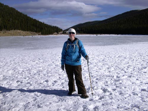
Lost Lake Winter Trip, Nederland

posted in: Winter | 0
Lost Lake is one of those secluded little gems that few people know about, but the ones who do visit it again and again. This is an excellent winter snowshoe or cross country ski trip near Nederland, complete with backcountry tent campsites all around the lake if you choose to do some snowshoe backpacking! Round-trip distance is about 5.5 miles and I completed this trip in about 3 hours in snowshoes. Expect the time to vary considerably depending on how much time you spend at the lake and whether you snowshoe or ski. I found the cross country skiing to be overly difficult for my equipment and skill level, so I used my snowshoes instead. Plenty of people do ski this route though, so if you are a bit more of an advanced backcountry skier you can probably handle this route with no problem. Some people hike up to the lake and use old mining roads to ascend to the top of the surrounding peaks to get in some steep backcountry skiing. When I was there, there were ski tracks descending many of the surrounding summits. The route becomes hard-packed if we haven’t had any pow in a while, and large snow drifts form that can become a bit slippery when packed. During the first mile, look to your left and you will see two of the lifts that serve the more advanced terrain at Eldora ski area. The first lift you will see is the Indian Peaks lift, while the latter is the Corona lift. This area is very popular year-round with those who know about it, and parking can be a problem, especially in the winter. The only parking is along the road (after you have turned around first), but observe signs very carefully to make sure you are in a legal parking area. The line of parked cars can extend for quite a distance on the weekends, but during the week there will usually only be a couple of cars there.

Download Lost Lake Tracks and Waypoints (163 downloads)

Mt. Evans Echo Lake Loop

posted in: Winter | 0

This is my favorite short Mount Evans area snowshoe/cross country trail. It’s a very scenic loop with enough up and down for a bit of a challenge, all in the space of a couple hours. The total length is just over 2.5 miles. You can ski or snowshoe this one, take your pick. Or snowshoe up and ski down if you prefer.

We start off on the Echo Lake Trail near the shelter house (you can park on the side of the road there). Travel around the back of Echo Lake to the opposite side, where we begin our uphill section by taking the right fork to Chicago Lakes Trail. After a few hundred uphill feet, the trail comes to a sign for Chicago Lakes Trail. Do not follow the Chicago Lakes Trail, but instead stay left following the tracks up to a ridge top with amazing vistas. From “Overlook2”, follow the tracks a few hundred more feet until you come to the “Turnoff” waypoint. You are now on the Mount Evans Road near mile marker 1. Follow the road back down until you see the “Turnoff2” waypoint. Turnoff2 is actually the true trailhead for the Chicago Lakes Trail. Follow the Chicago Lakes Trail until it branches toward Echo Lake at the waypoint marked “branch here at sign”, and take the Echo Lake Trail back to the starting point.

It might be somewhat difficult to find Mt. Evans Road from the ridgetop if you don’t have a GPS, so be aware that those of you without a GPS might have trouble with route-finding on this one. But, with a GPS, it’s easy.

Download Echo Lake Tracks and Waypoints (154 downloads)

Mt. Tom Wreck Site (in memory of those who perished)

posted in: Are You Kidding Me? | 0
NOTE: I have had to remove much of the information regarding the Mt. Tom wreck site including the hiking directions per the landowners request. The landowner does not want anyone hiking on his property without express permission. Unfortunately different landowners have different attitudes, and we have to respect the landowner’s rights regardless.  

Sometimes the real tragedy lies in the nature of the casualty…

On April 8, 1952, Capt. Hilton B. Wilcox, Jr. and Lt.Col Merrill E. Smith lost their lives in a B-25 bomber crash in the area of what is now Golden Gate Canyon State Park. This hike takes you to the crash site. Unlike most touristy war memorials, there are no concrete walkways, statues, and bronze plaques. What lies here is as real as it gets: raw plane wreckage scattered over a beautiful mountainside. There is no trail to the site, this is a backcountry bushwhack all the way. The journey through sawmill gulch might just be too much for you, but if you can make it through, you will be rewarded with a fascinating, if not solemn, experience. I ask that you remember what happened here and respect the area for what it is. Please leave everything as you have found it. At first this wreck may seem senseless, but if you ascend to the top of the wreckage area and look eastward, you can clearly see how this could have happened. Also, here is a link to another site about the plane wreck site: Colorado Wreck Chasing Site .