The things I have to have.

posted in: We Women Hike Too | 0

This is a list of the things that I really have to have on a hiking trip if I want to be comfortable. This is not a supply list of everything that you need on a hiking trip. These are just the things that make my trips more enjoyable.

  • Hat and sunglasses. If I am ever caught outside without these essentials, I regret it. I get hot and irritable, which makes everyone else irritalbe.
  • Trekking poles. They make going uphill a lot easier and balancing on rocky terrain a lot more manageable.
  • Tissues. They are napkins when you forget them, TP when you need it and a lifesaver if you have allergies.
  • Lip balm. Since I breathe with my mouth open while hiking my lips get really dry and nasty if I don’t use lip balm. I always use the kind with sunscreen.
  • Pants, not shorts. You never know when you’ll be walking through grass or bushwacking through the shrubs. Pants protect you legs from scratches and help when you’re walking through a field of poison ivy.
  • High top hiking boots. I’m a pretty clumsy hiker and don’t trust myself hiking unless I’m wearing high top boots to help protect my ankes.
  • Any kind of t-shirt, as long as it’s not cotton. Cotton will get wet and sweaty and stay that way. Get a wicking material and you’ll be much more comfortable.
  • My iPod. I know, when you’re hiking you’re supposed to be one with nature, not listening to cheesy music. Well, when you’re hiking 10 miles in a day, it’s more like an athletic event than a meditational experience. My iPod helps me keep my hiking rhythm and lets those miles go by faster. Besides, I listen to Joh Denver and Bluegrass, not top 40 cheese.
Where are the women hikers?

posted in: We Women Hike Too | 0

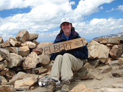
I want to share with you a conversation that I have had many times. Some guy at work will ask me about my weekend and what I did. I’ll say something like, “Oh it was fun. My husband and I did this great day hike in Rocky Mountain National Park”. Then the guy proceeds to tell me that it’s so great that I hike and he wishes his wife/girfriend would hike with him too.

I guess I’m writing this because I wish women had more of a presence in the hiking world. There are many women hikers, but I would like to see more. The best reason that I can come up with as to why women don’t hike (besides just not wanting to, which is fine) is the fear of the unknown. We don’t exactly know what you do on a hike, how hard it is, where you go to the bathroom and what to bring.

My best suggestion to you is to start off slow. Pick some smaller and easier hikes to get started. The hikes in the Easy Hikes section of this website are good ones to start off with. If you don’t live in the Rockies, then you can always start in the county or state parks. Begin with short hikes that are on well marked trails.

Basically, you just hike during a hike. You walk for a few miles up the trail, look at some cool stuff, then you turn around and go back. After I finish a hike, I always have a great sense of accomplishment, espcecially if the hike was a hard one. A hike is as hard as you want it to be. Read trail descriptions and choose something that you feel comfortable with. The popular trailheads usually have toilets or latrines. I can’t include an entire list of what you need to bring. My suggestion to you is to consult with other hikers and use your common sense. If you start off on the easy stuff then the harder hikes won’t seem so impossible.

If you have one bad experience, don’t assume that all your experiences will be just as bad. I have a lot of people tell me, “Oh I went hiking one time and it rained and rained. We had an awful time!”. Then, that person never goes hiking again. You are going to have some bad trips, and you are going to have some good ones. My last piece of advice, if you go with someone that is faster than you, that’s okay. Your partner will just have to slow their pace down to match yours. It’s easier for your hiking partner to slow down for you then for you to speed up for your partner. You can’t overexhert yourself on the trail, or you’ll be doubled over having an asthma attack in no time. Trust me, I’ve learned this from experience.

Well, I hope this article has convinced one or two of you to try hiking. If it’s not for you, that’s fine. Just remember, the next time someone asks you what you did this weekend, you can say, “I did this really great dayhike in the woods!”.

White Ranch Trails Overview, Golden

posted in: Park Overviews | 0

White Ranch Open Space Park is a Jeffersion County park in the foothills north-west of Golden, Colorado. There are a variety of well-maintained trails for all ability levels. Most trails are long enough to provide a good workout, with excellent views, both of the mountains and of the city. You can get a taste for foothills geology in this area as some of the trails have excellent hogback and cliff views.

Getting There: There are three parking areas that access White Ranch. The main parking area is located at the end of the road that goes through the park. To get to this parking area you take Golden Gate Canyon Road and turn on Crawford Gulch Road just after The Golden Gate Grange. After a few miles on Crawford Gulch Road you will see the sign to turn into the park. The main lot is at the end of the road, or there is a side lot about a mile before the main one. There is another trailhead closer to downtown Golden on West 56th Ave that accesses the Belcher Hill Trail along an easement that crosses some high-end homes.

Over time we will be adding all of the major trails in White Ranch. Trails are listed in order from easiest to hardest. Click on a hike to go to the details and track download for that hike.

1. White Ranch Sawmill Trail.

2. White Ranch Rawhide Loop.

If you want to spend the night, there are some nice hotels in downtown Golden, or stay in Lakewood near the Colorado Mills Mall for less expensive lodging options. You can camp in nearby Golden Gate Canyon State Park at Reverend’s Ridge Campground if you don’t want to stay at the White Ranch primitive camp sites.

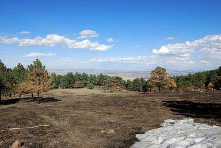
White Ranch after a routine burn.

Centennial Cone Overview

posted in: Park Overviews | 0

Centennial Cone is a scenic foothills park between Golden and Black Hawk, Colorado. The park offers challenging, lengthy trails that are favorites of hikers and mountain bikers. Trails often have steep ledge dropoffs, but the reward is expansive foothills views.

This park has some unusual rules which you should be aware of:

1. The park has decided to close Elk Range Trail during the spring for Elk Calving. For 2009, it re-opens June 16th. Elk Range Trail is an important connector that makes loop trips possible, so plan accordingly.

2. On Saturday and Sunday the park is restricted to mountain bikers on even numbered days and hikers on odd numbered days. During the week the park is open to everyone.

3. Centennial Cone Park is CLOSED in December and January.

Getting to Centennial Cone Park:

There are 3 parking areas. The main parking area serves as the starting point for the Travois Evening Sun hike. The west parking area is the starting point for the Centennial Cone Summit hike. The two parking areas are joined by the Elk Range Trail which is closed during the spring. There is a third parking area along Route 6 after Tunnel 3 which serves as the starting point for the Mayhem Gulch Trail.

Main Parking Area Directions: Take Golden Gate Canyon Road, turn left onto Robinson Hill Road, then proceed straight where Robinson Hill bends, turning onto Camino Perdido. Signs direct you there from Golden Gate Canyon Road.

West Parking Area Directons: Take Golden Gate Canyon Road, turn left onto Robinson Hill Road,  turn onto Douglas Mountain Drive, and follow signs to the parking lot.

The GPS track download includes the roads between Route 6 and Golden Gate Canyon Road so you can find the trailheads easier.

Individual Hike descriptions:

1. Centennial Cone Summit.

2. Travois-Evening Sun Loop.

3. Mayhem Gulch – Juniper Loop

Download all Centennial Cone tracks and waypoints:

Download Centennial Cone Tracks and Waypoints (235 downloads)

If you are a mountain biker, the loop trail that goes around the park is really nice. It’s 11.6 miles around, mostly single track, and there is A LOT of up and down. It traverses some fairly narrow ledges in places, with freaky dropoffs that provide great views. There are usually trail maps at the two parking areas. Most of the mountain bike route is on the Travois Trail, except for the section in between the two parking lots which is the Elk Range Trail (closed in spring).