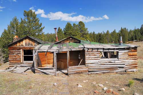
Homestead Meadows lies between Estes Park and Lyons, and is accessed from the Lion’s Gulch Trailhead off of Route 36 near mile marker 8. It’s a great trail for history buffs and anyone who wants to see how Colorado’s early pioneers lived.
The trail up Lion’s Gulch is very rocky and has some extended steep sections. The forest service has attempted to make this a family friendly trail, but it’s pretty tough for the young ones. I see plenty of people turn around on this trail without ever seeing a homestead. The worst section begins where I have “Bad Talus” marked, and it finally eases where I have “EZfromHere” marked. After that mark, the trail gradually levels out and opens up into the expanse of the meadows.
The route that I took led me past 5 homesteads, and there is a sawmill nearby, signs will direct you to it if you want to see it. Signs at the homesteads tell of the families and their lives, as well as explain a little about the Homestead Act of 1862. If you want to see even more homesteads, you can turn left at the junction that I have marked as Junction 1, but this adds considerable length to the trip and may be too long for a day hike.
The total trip length of the tour I tracked, passing 5 homesteads, is about 10 or 11 miles depending on how much you wander around the homesteads.
Mountain Bikers: Bikes are allowed on this trail and I’ve tried it myself. I’m not sure that it’s worth it though. It’s great to have your bike at the top to travel through the meadow, but hauling it up Lion’s Gulch is an arduous task that left me fairly exhausted. Not to mention that you have to haul it back down long stretches of trail that are too rocky and loose to ride. Personally, I don’t recommend it unless you have a super lightweight bike.
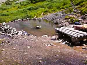
A magical place, the Conundrum Hot Springs in the Maroon Bells-Snowmass Wilderness near Aspen, Colorado is a must-do for Colorado backpackers. Only a few natural hot springs like this one are left undisturbed by man.
The reward for your exertion on the 8.5 mile trail is a soak in one of two beautiful hot spring pools with expansive views provided by the treeline location. The lower pool is cooler, smaller, and more private. It can hold about 4 people. The upper pool is much larger and can probably accommodate a dozen people before things start getting crowded. I would guesstimate the upper pool averages around 95 degrees (F) and the lower pool about 80 degrees, which in the cool Alpine air is just perfect. The temperature of the upper pool varies quite a bit depending where you sit. You will see the bubbles coming out of the ground indicating the source and the warmest area.
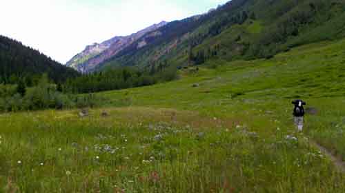
This is more than a backpacking trip, it’s an adventure.The beauty of soaking in a hot spring in the alpine air surrounded by tall mountains is exhilarating. There are amazing views to the North, down the valley you hiked through, into Aspen. To the east and west you have high mountain ridges, the east side being the most interesting with Castle Peak and Conundrum Peak towering above you. They are both 14,000 foot peaks, although Conundrum isn’t officially on the 14’ers list because it shares a ridgeline with the higher Castle Peak. Some people choose to make an ascent of one or both of these peaks during their stay, but as far as I know this is no easy task. It’s very steep talus from the hot springs up to the ridgeline.
Clothing is optional at the pools and more people choose to swim in the buff than with swimsuits. Keep this in mind if you’re bringing children. There are 16 campsites in the area of the hot springs. Roughly 8 of them are a close walk to the springs, the rest are a bit more distant. The sites have some isolated trees near them, but you are at treeline and storms can be dangerous. Make certain your gear is up for the weather or camp lower if there is any doubt (we brought our 4-season mountaineering tent which was perfect for the conditions but a bit heavy in the pack). Site 6 is the best because it is literally a stone’s throw from the upper pool. Campfires are not allowed at any of the 16 sites in the area of the pools, however, on your hike up you will pass a sign that says “Camp Fire Sites”. These sites are probably 3/4 of a mile from the springs, but they allow fires and serve as an overflow if all 16 sites near the springs are taken. They are also in dense forest and therefore are better protected from storms.
Hiking to the best Hot Springs in Colorado
On our trip, we encountered perfect weather on our first day, except for the brief period when we were setting up our tent (it always seems to storm when we’re setting up the tent).It took us about an hour just to find a camp site (we arrived at the springs around 5:00pm). There is a sign with a map of the campsites near the springs. By the time we arrived, the close ones had all been taken, and in fact there were only a couple sites left. We finally found site 14 up in the triangle pass sites, and set up camp there. It was a fairly long walk to the hot springs from this site.
We relaxed in the pools that evening, first starting in the cooler lower pool where we were alone. After about a half hour of soaking in the lower pool, 3 Pine Martens playfully ran up to the pool. One of them came up close and looked at us, let out a loud squeak, and ran back into the bushes. We eventually moved up to the more social and warmer upper pool, which probably had about 10 people total in it. On the next day, we awoke and took another soak in the pool and then packed up and headed down. As soon as we started to pack up around noon, the storms rolled in, and they were severe, with some close lightning strikes and pea-sized hail. We had to rush to get in the denser forest where we were safer from the lightning.
After a trip of this nature, you can relax in Snowmass or Aspen and reflect on the beauty of the experience, and of the difficulty in reaching it, content in the knowledge that few people on earth can even make the trip to the remote wilderness you just traversed. The aches and pains will become evident as you no longer have your hot spring to wash them away, but a warm bath will help. Before long, you will be trying to find the time to make the trip again. And you will, because it’s just too good to pass up.
How to get there: The road leading up to the trailhead is called Castle Creek road. There is a roundabout near the Aspen airport, and you enter Castle Creek road from that roundabout. Take the road for 5 miles, then turn right onto Conundrum Road. Take Conundrum Road until it’s very end, being careful not to turn onto any private drives. The road turns to dirt and becomes narrow and more difficult the farther you proceed, but most 2 wheel drive vehicles can make it without issues. There is a large parking lot at the trailhead, although it does come close to filling up at times.
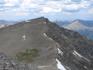
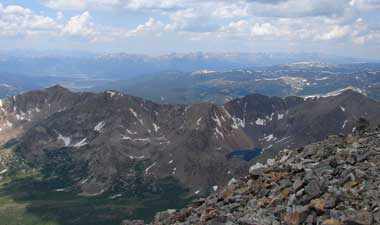
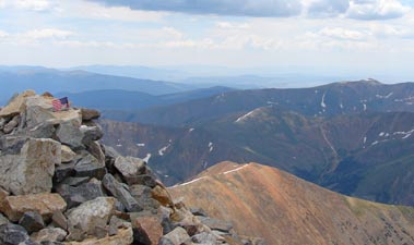
This trip is easy if you only summit Grays, but adding Torreys will provide just enough up and down to make it interesting. In my opinion these two mountains offer the best summit views of any I have climbed.
This hike is off of I-70 near Loveland Ski Area. Take I-70 to exit 221 (Bakerville). Immediately off of the exit you should see the start of the road to the trailhead, just south of the interstate. The trailhead parking area is at the end of a very rough 3 mile long road. Although I see Honda Civics and Toyota Corollas in the parking lot from time to time, I personally wouldn’t recommend it. You really need a high clearance vehicle to minimize the chance of damage.
There is a parking lot immediately off of the interstate that many people choose to start from to avoid driving the rough road. This will add around 6 miles to your roundtrip hiking distance.
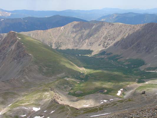
From the trailhead parking lot, expect the trip to take 6+ hours and cover around 8.5 miles. The trail forks as you get close to the mountains. Take the left fork to reach the summit of Grays. From Grays, a rough trail descends the peak, goes through the saddle between the two mountains, and up to Torreys. Return from Torreys via that same trail, but this time cross the snow field (it is almost always there) to descend back to the main trail at the fork. There are huge cairns and signs to help guide you in the event of GPS failure.
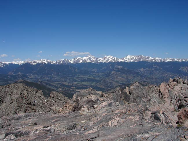
Because of it’s location well east of the continental divide and south of Estes Park, Twin Sisters Peak is often hikeable when other 11,000+ foot mountains are snowed in. This allows for some great spring/fall summit bagging.
The trailhead was moved a few years ago, so old descriptions of the Twin Sisters trail may be inaccurate. These tracks are recent, starting from the new trailhead near Lily Lake, and ascend to the top of the false summit. From there, it’s a no-brainer to the true summit.