Snake River Snowshoe Trail at Keystone

posted in: Winter | 0
Keystone has an excellent and reasonably affordable Nordic center if you are interested in using their facilities, but there is also good snowshoeing right along the small Snake River. This short and easy trail wanders along the river behind some nice homes. Parking near the start could be an issue for you, but if you solve that problem this is a great scenic snowshoe hike. If you don’t have a car spotted at the other end, the best place to turn around and head back is at the science school. In fact you might be able to park just outside the science school and begin your trip from that end, avoiding parking in the neighborhood. It all depends on what you can find and what the snowplows have been up to.
Download Keystone Snake River Tracks and Waypoints (188 downloads)

Up Mount Evans from Echo Lake, near Idaho Springs

posted in: Winter | 0
There is a trail leaving the parking area next to Echo Lake that few people know about. Most people just snowshoe up Mt. Evans road from Echo Lake, but if you follow these tracks you will find a wonderful, but narrow, trail for more experienced cross country skiers. This trail is best for nordic skiers who can handle tight tree terrain. If you are on snowshoes, please do not step on the cross country ski tracks! We hate it when you do that! Those tracks are important for skiers and should not be trampled. I have only tracked a short distance up this trail because it was very late when I got there and I ran out of time. But you can figure it out from there, and hopefully the tracks will be in the snow for you to follow anyway. This download also contains the entire road route from Idaho Springs past Echo Lake and Echo Mountain ski area to Bergen Park near Evergreen. There are excellent stops all along this route for snowshoeing and skiing.

Download Mt Evans Ski Trail Tracks and Waypoints (200 downloads)

Naylor Lake, Guanella Pass, near Georgetown

posted in: Winter | 0
This track takes you to Naylor Lake in the Guanella Pass area, near Georgetown. This is an absolutely beautiful area in the middle of winter, a large frozen lake situated at tree line with tall alpine peaks all around. Take notice though that the lake and the immediate shore around the lake is private property. The tracks skirt along the side of the property line.   This trip is good to ascend on snowshoes and/or XC skis. There is alpine skiing beyond the lake if you have the skill and equipment to try it, but beware of avalanches.   This terrain is steep enough to snowshoe up and then Alpine ski, Snowboard, or Tele back down if you really want to have some fun.   Avalanche Danger: The avalanche danger along these tracks is low since it is in thick forest right up until the end. The trail ends near the lake in a low angle area that is also not prone to avalanche. IF you proceed past the tracks, you will definitely be in avalanche territory. You should not be there unless you are trained and experienced in avalanche safety and have the required equipment.   This download includes a track to take you along the drive from Georgetown up the Guanella Pass road, to the parking area 8.2 miles up the road where feet of fresh powder await you. This road is plowed during the winter but it gets a layer of hardpack on it, so make sure you have a vehicle that can handle the conditions. Also, there is road construction throughout the winter on this road, so you may have to stop in places where the road has been reduced to 1 lane. Delays can occur as crews sometimes need to block the road for short periods.

Download Guanella Pass Tracks and Waypoints (162 downloads)

Fairburn Mountain In Winter, Black Hawk

posted in: Winter | 0

Fairburn Mountain is an all too often overlooked peak in the Gilpin County high country, in Arapaho National Forest near Black Hawk. It’s easily accessed from Cold Springs Campground. The campground is closed during the winter, but there is room to park along the side of the road. You can either park next to the closed entrance gate (there is a No Parking sign on the gate so I don’t park in front of it, but there is room off to either side of the gate that lots of people use for parking and I haven’t seen anyone ticketed yet). If the parking next to the gate is full, just park up the road a couple hundred feet, the pulloff is wide there and you can walk through the Aspens over to the picnic area. Be careful you don’t get stuck when parking, the snow depth can be deceptive on the road sides. The summit altitude is around 10,420 feet. My winter snowshoeing round trip was probably around 5 hours. I wouldn’t recommend this trip on XC skis, as it’s too steep and the trees are dense. There is an excellent xc-ski trail in this area though, check out my Cold Springs Ski Tour winter trip for details.

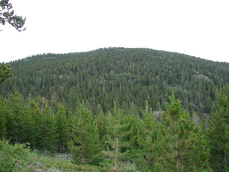
I first summited this mountain in January, since, looking out my westward window, I could see that the mountain was lonely. A winter summit of this mountain requires good snowshoes and fairly high-end winter gear. The wind is generally calm here in the mornings, but it can often get intense in the afternoons. Even though the distance is short, this off-trail backcountry trek is steep. You’ll need snowshoes which have a large amount of displacement for your weight. The tiny shoes I see some people wearing will just sink right in. My Atlas Series 7’s got the job done even though I had to slough through nearly 2 foot deep drops in certain areas. MSR Denali Ascent’s with extenders would probably be the best. There is a summit register here and a geocache, but it is unlikely that you will find either in the winter. All the more reason to return for the summer bushwhack version of this mountain! Here is a link to the Geocache in case you want to look for it, but when I tried, it was quite buried. Finding it during the summer was cake: A Fairburn Bushwhack

Download Fairburn Tracks and Waypoints (202 downloads)