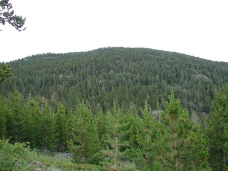
Fairburn Mountain is an all too often overlooked peak in the Gilpin County high country near Black Hawk. It’s easily accessed from Cold Springs Campground, which has a free picnic area parking lot, perfect for day hikers. The summit altitude is around 10,420 feet. My summer roundtrip was nearly 3 hours, although I spent quite a bit of time on the summit. Fairburn mountain summit as seen from the route.
There is a summit register here and a geocache. You can see by checking both of the logs that this is a lonely mountain. It’s a great trip for a bit of trailless backcountry solitude. Be aware of Bears in this area! Activity is very heavy. Here is a link to the Geocache: A Fairburn Bushwhack
This is a super-easy Golden foothills loop hike of considerable length for families or easy-going days, known not only for it’s phenomenal views but also for the variety of terrain you encounter on the various sections of the trail.
There is a campground near the half-way point (Sourdough Springs Equestrian Camp) with 8 reservable sites, great for picnicing if you don’t want to spend the night. The campground has sites with picnic tables, firepits with grill tops, buckets for carrying water, seasonal well water, a vault toilet, firewood, and garbage cans.
I prefer the cooler climates of spring and fall for foothills hikes like this one, but it’s fun year-round, although you may want spikes in the winter as there are some icy slopes. Many people mountain-bike this trail as well.
I left the Rawhide Trail briefly to take the Waterhole Trail through the campground, it makes the trip slightly shorter. Also, if your group starts hiking but doesn’t seem up to the full 4.2 miles of this trip, you can take Wrangler’s Run Trail as a shortcut directly to the Stream crossing waypoint.
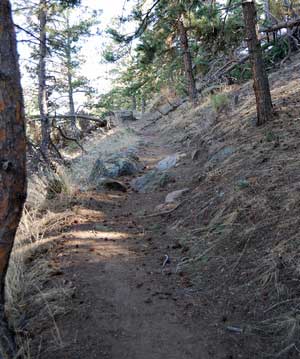
There are usually flyers with trail maps at the trailhead. If you follow the loop in the same direction that I did, you start out on a horse trail in an open field area. At the end of the Waterhole Trail things get narrow as you traverse around a hillside, and the trail descends into the forest. It reaches its low-point at a stream crossing, which is also the location of the end of the Wrangler’s Run Trail. The trail climbs steeply from here back to the open field area.
The Sourdough Springs campground is really excellent for easy backpacking overnighters. It is used both by horseback riders and backpackers (if you don’t want the possibility of horses nearby, stay at the Sawmill backpacker campground instead). This is the best developed backcountry campsite I have ever seen, a great easy overnight hike for families. For backpacking, you need a free overnight pass which is available at the trailhead. Just follow the instructions on the backpacking kiosk at the trailhead. The drop slot for the permit is a little tricky to find, just look behind the stack of permits and sure enough there is a slot back there.
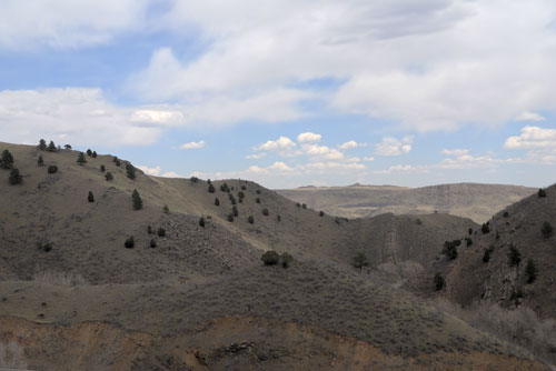
Mount Galbraith is a Jefferson County Open Space Park in Golden, Colorado. The main feature of this foothills hike: the views! There is no better place to get a sense of the topography of the Golden area, than from the vistas along this trail. Then you round a bend and are blown away by the distant views of Mount Evans. This trail is narrow in places with some impressive dropoffs and some rocky ledge crossings, but overall it’s very easy. It’s a fairly exposed trail with a few short jaunts under the cover of trees. Total length is 4.3 miles and it took me about 2 hours of casual walking to complete it.
Try to only visit this trail during non-peak times. The parking lot overflows onto the road and creates a dangerous traffic mess during most weekends.
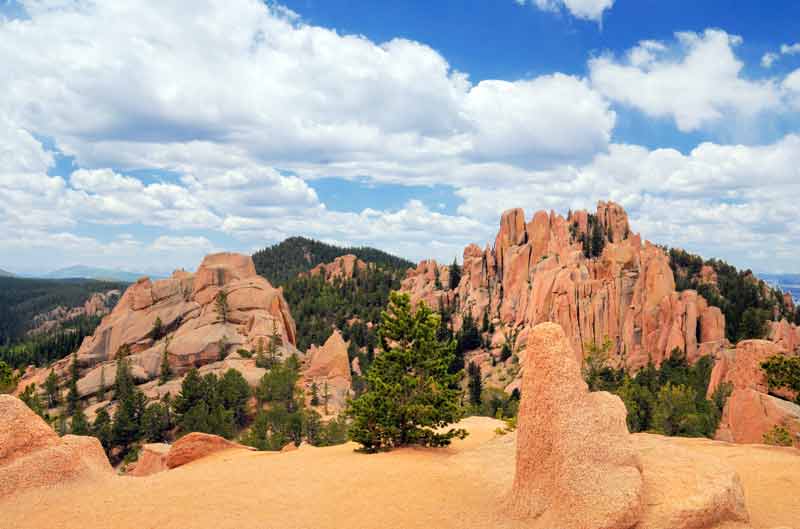
This hike is very simple to describe: If you like the Garden Of The Gods scenery but can’t stand the hoards of tourist gawkers that have never set foot off of pavement in their lives, this is the hike for you! It’s a gentle slope until you get to the crags, where things become a little steeper and gravelly, but nothing you can’t handle. The Crags are truly something to see. This hike is a popular kid-friendly trip for the handful of families who know about it. The dirt road is fairly rough until you get past the Mennonite Camp. There is a primitive campground at the trailhead which is suitable for tents, truck campers, and small beater trailers/RVs (don’t bring your nice camper trailer or RV because the road will really beat it up).